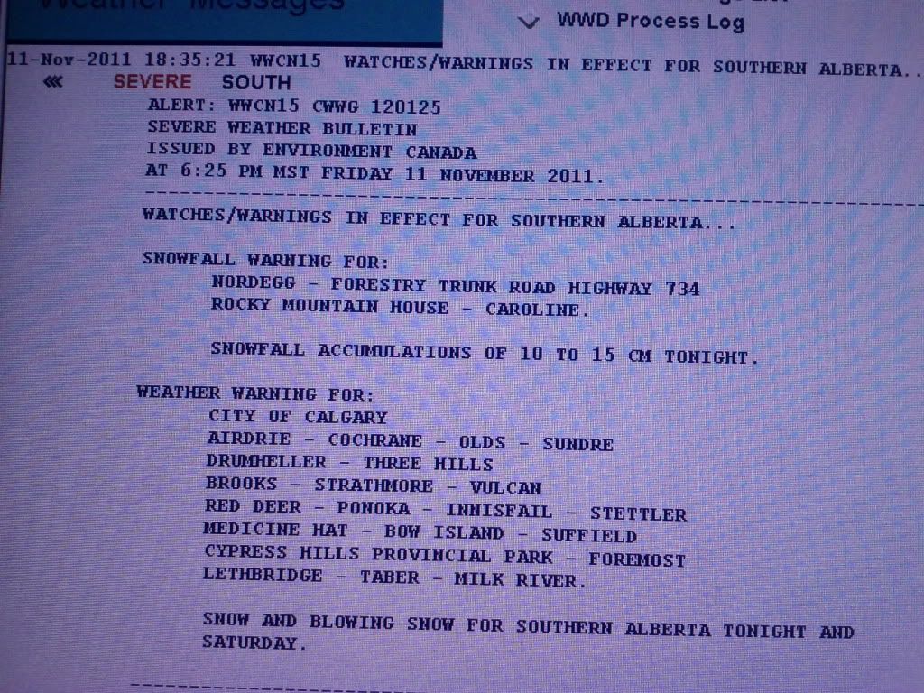
http://www.theweathernetwork.com/ale...nings_citypageSummary: Snow and blowing snow for Southern Alberta tonight and Saturday.
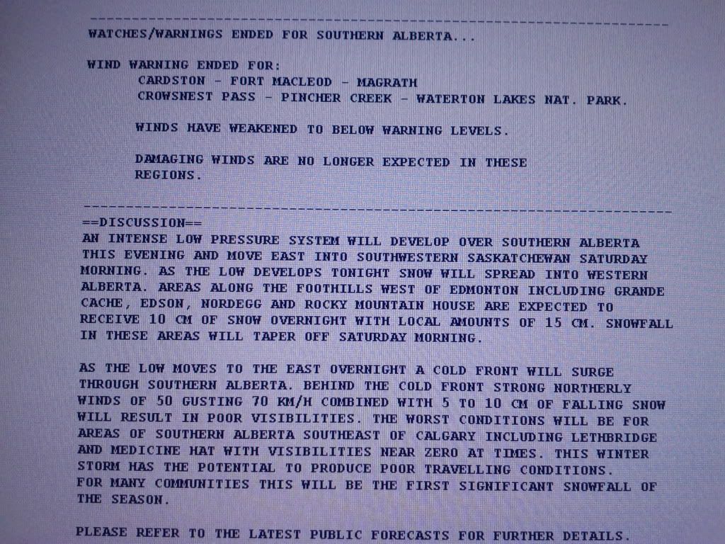
Details: An intense low pressure system will develop over Southern Alberta this evening and move east into Southwestern Saskatchewan Saturday morning. As the low develops tonight snow will spread into Western Alberta. Areas along the foothills west of Edmonton including Grande Cache, Edson, Nordegg and Rocky Mountain House are expected to receive 10 cm of snow overnight with local amounts of 15 cm. Snowfall in these areas will taper off Saturday morning. As the low moves to the east overnight a cold front will surge through Southern Alberta. Behind the cold front strong northerly winds of 50 gusting 70 km/h combined with 5 to 10 cm of falling snow will result in poor visibilities. The worst conditions will be for areas of Southern Alberta southeast of Calgary including Lethbridge and Medicine Hat with visibilities near zero at times. This winter storm has the potential to produce poor travelling conditions. For many communities this will be the first significant snowfall of the season. As the Lee low begins to develop today strong westerly winds will remain over extreme Southwest Alberta this afternoon. Winds will gradually ease this evening as the low begins to move off the foothills.


 Quote
Quote